Khao Nam Yot Fm
Period:
Triassic
Age Interval:
Upper Triassic (13, 14)
Province:
Indochina Block: Loei Fold Belt
Type Locality and Naming
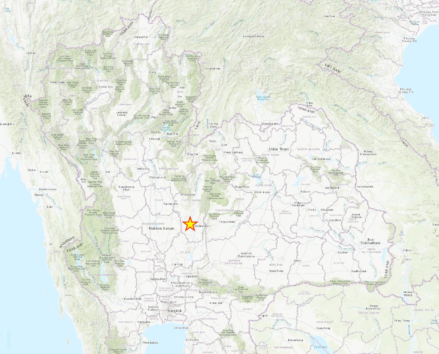
At Khao Nam Yot, Wichian Buri district of Phetchabun province (Jungyusuk, 1988).
Synonym: หมวดหินเขาน้ำหยด
[Figure: Screenshots from ESRI topographic map (from QGIS) with type locality highlighted with a star]
Lithology and Thickness
Limestone conglomerate, 80-90% clasts of limestone, interbedded with red sandstone. Thickness: 100 m.
Lithology Pattern:
Sandy limestone
Relationships and Distribution
Lower contact
uncertain
Upper contact
uncertain
Regional extent
Central Region: Wichian Buri district of Phetchabun province. [Geo-JSON omitted because would conflict with other Khorat units until more details are available.]
GeoJSON
{"type":"Feature","geometry":{"type":"MultiPolygon","coordinates":[[[[102.02,18.14],[102.05,17.98],[101.97,17.7],[101.95,17.22],[101.81,16.98],[101.6,16.66],[101.39,16.3],[101.32,15.87],[101.36,15.43],[101.46,14.84],[101.59,14.22],[101.54,14.11],[101.21,14.16],[100.97,14.27],[100.85,14.4],[100.76,14.69],[100.69,15.01],[100.63,15.29],[100.65,15.59],[100.57,15.82],[100.5,16.15],[100.5,16.37],[100.49,16.59],[100.52,16.8],[100.43,17.02],[100.39,17.29],[100.47,17.36],[100.76,17.57],[100.89,17.62],[101.01,17.5],[101.27,17.55],[102.02,18.14]]]]}}
Fossils
Age
Age Span:
Beginning stage:
Norian
Fraction up in beginning stage:
0
Beginning date (Ma):
228.45
Ending stage:
Rhaetian
Fraction up in the ending stage:
0
Ending date (Ma):
209.56
Depositional setting
Depositional pattern:
Compiler:
Wen Du -modified from Lexicon of Stratigraphic Names of Thailand of 2013
